


GLIERES / BORNES: COL DU COU - CHALET DE BALME

djeepee74
User
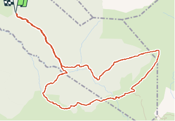

Length
7.1 km

Max alt
1612 m

Uphill gradient
438 m
Km-Effort
13 km

Min alt
1176 m

Downhill gradient
435 m
Boucle
Yes
Creation date :
2022-08-12 07:46:03.741
Updated on :
2022-08-14 13:02:42.565
3h02
Difficulty : Easy

FREE GPS app for hiking
 SityTrail
IGN / Geographical institutes
SityTrail Plus
The world is yours!
About
Trail Walking of 7.1 km to be discovered at Auvergne-Rhône-Alpes, Upper Savoy, La Roche-sur-Foron. This trail is proposed by djeepee74.
Description
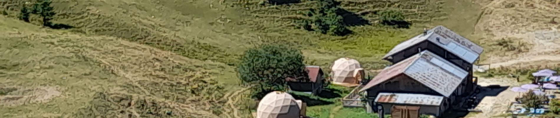
BOUCLE... live du 20220812
Photos


Positioning
Country:
France
Region :
Auvergne-Rhône-Alpes
Department/Province :
Upper Savoy
Municipality :
La Roche-sur-Foron
Location:
Unknown
Start:(Dec)
Start:(UTM)
292899 ; 5099798 (32T) N.
Comments